
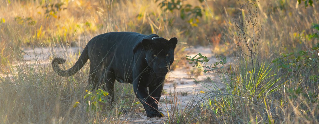
What happens to a jaguar’s territory as the landscape it moves through changes? This was one of the questions explored by Onçafari during the launch of MapBiomas Collection 11. Invited to participate in the demonstration of the new Meu MapBiomas platform, Onçafari presented a live study based on monitoring data from Simplício, a melanistic jaguar living in the Grande Sertão Veredas region and around Pousada Trijunção.
The presentation demonstrated how an animal’s home-range data can be combined with information on land use and landscape changes. This combination helps provide a better understanding of the challenges faced by wildlife and supports more effective conservation decisions.

Simplício as a Starting Point
Monitored by Onçafari since 2024 using a radio collar, Simplício has movement data that make it possible to map his home range and understand how he uses the landscape over time.
But knowing where a jaguar moves is only part of the story. To understand the challenges it faces, it is also necessary to look at what is happening in the landscape where it lives.
During the demonstration, the Meu MapBiomas team overlaid Simplício’s home-range data with information on the area burned in the past year, fire recurrence, and land use and land cover history between 2018 and 2025, a period that coincides with Simplício’s lifetime.
This made it possible to build an analysis connecting two types of information: data generated through wildlife monitoring and environmental information available on the MapBiomas platform.
The results revealed how the region where Simplício moves has been changing. One of the main findings was the expansion of agriculture; approximately 60,000 hectares within Simplício’s home range have been converted into soybean fields since his birth.
Despite the presence of large open areas, the data shows that Simplício almost always chooses to move through native vegetation. The exceptions occur when he needs to cross agricultural fields, usually driven by a specific situation such as the presence of a female on the other side of the field or the search for prey. In these situations, Simplício tends to cross at night when its exposure is lower.

-
- Crédito: Edu Fragoso

Meu MapBiomas
Presented during the launch of Collection 11, Meu MapBiomas is a new platform that allows organizations to create their own analyses and visualizations of territorial data.
Currently, 15 organizations are already using the platform, including Onçafari, SOS Mata Atlântica, Brazil’s Ministry of Environment, the Amazon Environmental Research Institute (IPAM), and the Amazon Cooperation Treaty Organization (ACTO). By December 2026, 100 access slots will be made available.
The tool brings together data already provided by MapBiomas, including information on vegetation, land use, agriculture, pastures, fire, and degradation. This information can be combined with an organization’s own data, such as animal home ranges, GPS collar monitoring records, protected-area mosaics, and private reserves.
In practice, this means that an organization does not need to start an analysis from scratch or rely on a geospatial analysis specialist. The platform was designed to allow different users to explore data and build analyses more independently.
From a Jaguar’s Territory to the Entire Landscape
Although Simplício was the starting point for the demonstration, the tool’s applications can go much further.
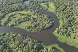
Data produced by Onçafari can be used to investigate different questions related to the landscapes where the organization operates such as analyzing the composition and transformation of a conservation area, studying ecological corridors and reserves, monitoring changes in land use, and cross-referencing this information with fire and degradation histories.
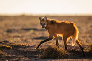
In the Anti-Fire program, the tool can help expand analyses of fire occurrence across Onçafari’s areas of operation. In the Science program, wildlife monitoring data can be correlated with changes occurring in the landscapes where these animals live, among other applications.

-
- Crédito: Leonardo Sartorello

-
- Crédito: Anna Bradbury

Access to the platform expands Onçafari’s ability to ask new questions and turn data into knowledge. This knowledge can contribute to conservation by helping us understand threats, guide strategies, identify priority areas, and share with society the transformations taking place across Brazil’s landscapes.